
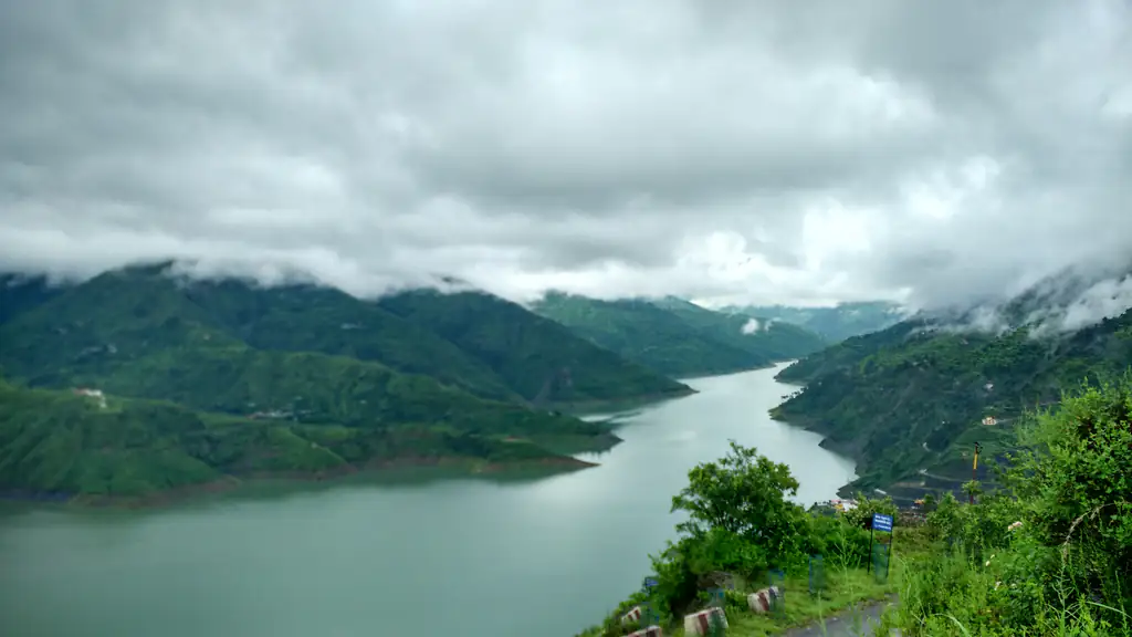
People call it the Chamba loop because Chamba is where the two roads from Dehradun meet. One climbs through Mussoorie, Dhanaulti and Kanatal along the ridge. The other runs through Rishikesh and Narendranagar. Go up one, come back by the other, and drop down to Tehri Lake in the middle. This page is about that loop. For Dhanaulti and the Surkanda Devi temple on their own, read our Dhanaulti and Surkanda Devi page.
Tehri Lake and Kanatal: key facts
- Distance
- About 110 km by road from the Clock Tower to Koti Colony on the lake via Mussoorie and Kanatal, and about 120 km back via Rishikesh and Narendranagar (OpenStreetMap routing, Nov 2026). Uttarakhand Tourism puts Kanatal 85 km from Dehradun railway station.Uttarakhand Tourism: Kanatal, checked 1 Nov 2026
- Drive time
- Uttarakhand Tourism says Jolly Grant Airport to Kanatal can be covered within about 3 hours. Allow at least that much from Dehradun to the lake each way, more on weekends and in bad weather.Uttarakhand Tourism: Kanatal, how to reach, checked 1 Nov 2026
- Lake water level
- THDC’s rule curve fills the reservoir in the monsoon, from 21 June to 31 October, towards its full level of 830 m. From 1 November it is gradually drawn down, to as low as 740 m before the next monsoon. At full level the water spreads over about 44 sq km; at the lowest, about 18 sq km.THDC: Tehri Dam O&M manual, section 2.2.4, checked 1 Nov 2026
- Boating after dark
- As of 16 Oct 2026 the Tehri District Magistrate ordered a complete stop to jet-ski rides and boating after sunset at the lake, after inspecting the Koti Colony boating point. Licences of operators who break the rule are to be cancelled.Dainik Bhaskar, 16 Oct 2026, checked 1 Nov 2026
- Paying for rides
- The same order says payment should go by QR code only into the authorised account of the Tehri Special Area Tourism Development Authority (TADA) or a registered boat union.Dainik Bhaskar, 16 Oct 2026, checked 1 Nov 2026
- Tehri Lake Festival
- The 2026 festival, Himalayan O₂, ran 6–9 March 2026 at the lake and was opened by the Chief Minister. The 2027 edition is expected around February or March, not yet announced.Himalayan O₂ official site, checked 1 Nov 2026
- Road closures
- Uttarakhand PWD lists closed roads live. Check it the evening before and again in the morning.Uttarakhand PWD road closure dashboard, checked 1 Nov 2026
The route: up the ridge, down by the river
We measure from the Clock Tower. These are road distances from OpenStreetMap, rounded to 5 km, as of 1 November 2026:
| Stop | By road from the Clock Tower | Notes |
|---|---|---|
| Mussoorie | About 30 km | The first climb. Traffic here sets the pace for the whole day. |
| Dhanaulti | About 60 km | Deodar forest and the eco parks. Surkanda Devi is just beyond. |
| Kanatal | About 75 km | A small ridge settlement on the Mussoorie–Chamba road. Uttarakhand Tourism gives 85 km from Dehradun railway station. |
| Chamba | About 95 km | The junction town. From here the road drops to the lake. |
| Koti Colony, Tehri Lake | About 110 km | The main boating point, near New Tehri. |
The way back is by the main road. From Koti Colony you climb back to Chamba, then take the highway down through Narendranagar to Rishikesh and on to Dehradun. That is about 120 km, longer than the ridge, but it is a national highway and easier on a tired driver. THDC’s own dam manual calls it the all-weather road to Tehri. Uttarakhand Tourism puts Chamba about 11 km from New Tehri and the Rishikesh railway station about 58 km before Chamba.
So the full loop is roughly 230 km of hill road. On a map that does not look like much. In practice it is a whole day at the wheel, and the numbers on a phone’s map app are usually optimistic for these roads.
Kanatal and Chamba on the way
Kanatal is a small place on the Mussoorie–Chamba road, with apple orchards, forest and wide views. Uttarakhand Tourism describes the Kaudia forest, about 5 km away, as an easy walk with springs and birds, and says Kanatal gets snow from December to February. On the loop it is a stop to stretch your legs and look at the mountains, not a destination with a list of sights.
Chamba sits at about 1,676 m, according to Uttarakhand Tourism’s Chamba page, on the edge of the Bhagirathi valley. This is where you choose. Down to the lake, or straight home by Narendranagar if the day has run away from you.
Tehri Lake: what changes through the year
Tehri Lake is the reservoir behind the Tehri Dam on the Bhagirathi. At 260.5 m, the dam is the highest in India, and it is run by THDC India Ltd. Old Tehri, once the capital of the Garhwal kingdom, went under the lake when the dam was built, and its people were moved to New Tehri. You can see the dam from the viewpoint near Bhagirathipuram, and Uttarakhand Tourism lists the Dobra-Chanti bridge across the lake as India’s longest motorable single-lane suspension bridge.
The thing most visitors don’t know is that the lake can rise and fall by up to 90 m in a year. THDC’s rules for the reservoir allow it to fill through the monsoon towards 830 m by the end of October, and to be drawn down from November to as low as 740 m before the next monsoon. At that lowest level, the water covers well under half the area it does when full. So a visit in late winter or spring shows a lower lake with more bare bank than one in October or November. How low it is on a given day depends on the year’s rain and the dam’s releases.
We could not find a published water-sports season from THDC or Uttarakhand Tourism. What they do say: Uttarakhand Tourism lists boating, zorbing and water skiing among things to do at New Tehri, and gives April to June and October to December as the best time to visit. On the water, the rules now come from the district. As of 16 October 2026, the Tehri District Magistrate had ordered all boating and jet-ski rides to stop at sunset. Check the Tehri district website for anything newer before you go.
We don’t recommend operators, and rates change, so we have left them out. Book at the official counters at the boating point, wear the life jacket you are given, and pay the way the district has asked, by QR code into the authority’s or the registered union’s account. Do not swim in the lake. It is a deep reservoir, and the water levels change.
In the monsoon
From July to September the ridge road is the risky part. On 22 August 2026 a fresh landslide on the Dehradun–Mussoorie road near Pani Wala Bend stopped traffic, and heavy vehicles were barred while repairs went on (India Today). Hindustan Times reported traffic being diverted by the Kimadi road that day, with more than 80 roads blocked across Uttarakhand. In the monsoon we would leave this drive for another season. If you go, check the roads that morning and be ready to turn back.
Before you go
- Forecast and warnings: as of 1 November 2026, the IMD Dehradun centre publishes district forecasts and warnings. Tehri Garhwal is the district for Kanatal, Chamba and the lake.
- Closed roads: the Uttarakhand PWD road closure dashboard. Our page on checking roads and weather lists the other places to look.
- Snow: after snowfall the ridge road past Dhanaulti and Kanatal can be blocked for a day or more. On 23 January 2022, Amar Ujala reported the Chamba–Dhanaulti road closed and the road beyond Kanatal blocked while JCBs worked on it. If snow is forecast, check the PWD dashboard for the Rishikesh road and think about using it both ways, or pick another day.
How we would plan the day
We are two friends from Dehradun. As our Instagram puts it, “We help our guests to experience the best of local places”. For the Chamba loop, our advice is mostly about time:
- Leave early. Get through Mussoorie before its traffic builds. You only need to pass through it on this drive.
- Go up by the ridge, come down by Rishikesh. The ridge has the views, and you see them best in the morning. The highway is the easier road for the drive home, when everyone is tired.
- Pick two things, not five. Kanatal and the lake, or Dhanaulti and the lake. Adding Surkanda Devi or a stop in Mussoorie turns a long day into one that ends on hill roads in the dark.
- Be off the water well before sunset. Rides stop at sunset anyway, and you still have the climb back to Chamba and the long drive home after it.
- Share the driving, or don’t drive yourself. If no one in your group is used to hill roads, hire a car with a driver for the day and agree on the route and stops before you set off.
- Dress for the ridge. Kanatal is much colder than the valley in winter. Carry a proper jacket, water, snacks and a full tank of fuel.
If you would rather not do it in one go, spend a night out on the loop and come back the next day. If you are staying with us, there is a courtyard where you can park and load the car the evening before. If you’d like Pahadi breakfast the morning after you return, tell us the night before.
Sources: Uttarakhand Tourism: Kanatal; Uttarakhand Tourism: Chamba; Uttarakhand Tourism: New Tehri; District Tehri Garhwal: Tourism; THDC India Ltd: Tehri Dam operation and maintenance manual; Dainik Bhaskar, 16 Oct 2026 (DM’s boating order); All India Radio, Dehradun bulletin, 20 Oct 2026; Himalayan O₂, the Tehri Lake Festival (official site); BW Hotelier, 9 Mar 2026 (Tehri Lake Festival); India Today, 22 Aug 2026; Hindustan Times, 23 Aug 2026; Amar Ujala, 23 Jan 2022; OpenStreetMap (road distances, 1 Nov 2026); IMD Meteorological Centre Dehradun; Uttarakhand PWD: road closure dashboard.